


Deer Island (Massachusetts)
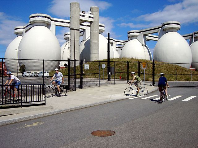
Deer Island is a peninsula in Boston, Massachusetts. Since 1996, it has been part of the Boston Harbor Islands National Recreation Area. Although still an island by name, Deer Island has been connected to the mainland since the former Shirley Gut channel, which once separated the island from the town of Winthrop, was filled in by the 1938 New England hurricane. Today, Deer Island is the location of the Deer Island Waste Water Treatment Plant, whose 150-foot-tall (46 m) egg-like sludge digesters are major harbor landmarks.
The island has a permanent size of 185 acres (0.75 km2), plus an intertidal zone of a further 80 acres (320,000 m2). Two-thirds of the island's area is taken up with the wastewater plant, which treats sewage from 43 nearby cities and towns, and is the second-largest such plant in the United States. The remainder of the island is park land surrounding the treatment plant, and offers walking, jogging, sightseeing, picnicking, and fishing.
-
1
History
- 1.1 1600s
- 1.2 19th-20th century
- 2 Modern recreational uses
- 3 Incidents
- 4 See also
- 5 References
- 6 Bibliography
- 7 External links
Links
Images Gallery
-
 Deer Island, Boston Harbor, 2008
-
 An 1888 German map of Boston Harbor showing Deer Island on the middle right side
-

-

-
 Wastewater treatment plant, water tower, Deer Island
-
 Almshouse, Deer Island, 1851
-
 The Deer Island wastewater plant and surrounding park area, 2008
-
 Walkers next to sewage digester tanks
-
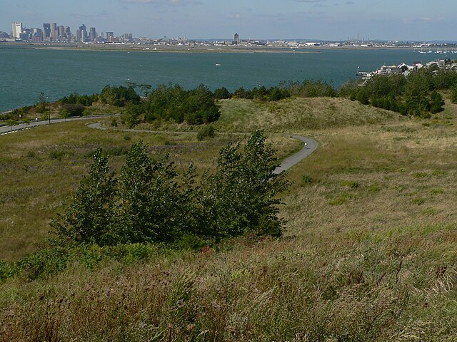 View of Boston from Deer Island
Comments
Share your experience with others and write the first comment about the location